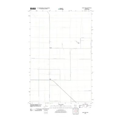
2010 Map of Four Town
USGS Topo · Published 2010About this map
Four Town and Malcolm anchor this sparsely settled portion of Beltrami County, mapped here in the early twenty-first century. The landscape is defined by a rigid grid of local routes and section lines, with long-stretching thoroughfares like Fourtown Rd NW and Dicks Parkway Rd providing the primary north-south connectivity. The presence of the Linder Lookout Tower near Swedes Jackpine Rd NW indicates the region's managed timber or forest monitoring character. A network of family-named roads, including Judees Rd, Jokela Rd NW, and Todroff Rd NW, suggests a community built upon long-standing rural homesteads and agricultural tracts. This 2010 survey provides a clear view of the modern road infrastructure that supports these small unincorporated settlements.
Find a feature on this map
19 named features on this map. Tap any name to fly to it.
Don’t see what you’re looking for? This feature index may not catch every label — zoom into the map to look around manually.
Map Details
Editions of this 2010 Four Town Map
This is the sole edition of this map. No revisions or reprints were ever made.
Other maps of this area

1918 · F
USGS Topo · 1:62,500

1918 · Malcolm
USGS Topo · 1:62,500

1918 · Jelle
USGS Topo · 1:62,500

1954 · Roseau
USGS Topo · 1:250,000

1957 · Roseau
USGS Topo · 1:250,000

1958 · Roseau
USGS Topo · 1:250,000

1973 · Gates Corner
USGS Topo · 1:24,000

1973 · Jelle NE
USGS Topo · 1:24,000

1973 · Thorhult
USGS Topo · 1:24,000
1973 · Shilling Dam NW
USGS Topo · 1:24,000