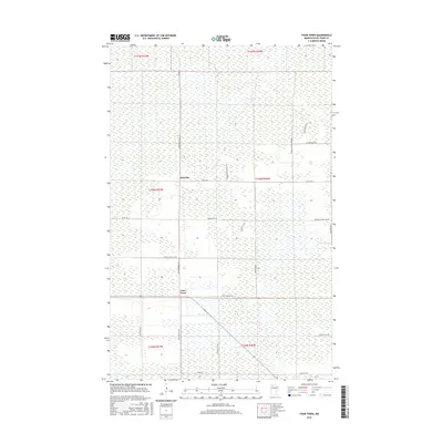
2016 Map of Four Town
USGS Topo · Published 2016About this map
Malcolm and Four Town anchor this northern Minnesota landscape, where the rectangular grid of the Public Land Survey System defines the human footprint upon a terrain of extensive wetlands. The map reveals a network of roads often named for local families and regional flora, such as Swedes Jackpine Rd NW and Diamond Willow Ln NW. These thoroughfares, including Dicks Parkway Rd and Jokela Rd NW, trace the high ground between vast marshy tracts. The presence of Grade School Rd NW suggests the historical location of local education centers that once served these dispersed rural communities. Boundary lines for Townships 155N through 157N underscore the late-stage development of this region in Beltrami County, where land use remains closely tied to the natural drainage patterns and forest management of the Upper Midwest.
Find a feature on this map
29 named features on this map. Tap any name to fly to it.
Don’t see what you’re looking for? This feature index may not catch every label — zoom into the map to look around manually.
Map Details
Editions of this 2016 Four Town Map
This is the sole edition of this map. No revisions or reprints were ever made.
Other maps of this area

1918 · F
USGS Topo · 1:62,500

1918 · Malcolm
USGS Topo · 1:62,500

1918 · Jelle
USGS Topo · 1:62,500

1954 · Roseau
USGS Topo · 1:250,000

1957 · Roseau
USGS Topo · 1:250,000

1958 · Roseau
USGS Topo · 1:250,000

1973 · Gates Corner
USGS Topo · 1:24,000

1973 · Jelle NE
USGS Topo · 1:24,000

1973 · Thorhult
USGS Topo · 1:24,000
1973 · Shilling Dam NW
USGS Topo · 1:24,000