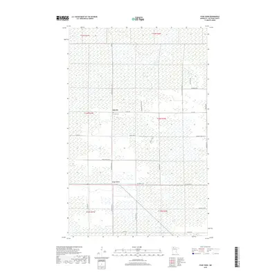
2019 Map of Four Town
USGS Topo · Published 2019About this map
The low-lying wetlands of Beltrami County define this landscape, where small settlements like Malcolm and Four Town provide clear markers of human geography in a heavily waterlogged environment. Near the center of the sheet, the Lone Oak Cem sits just south of Malcolm, a significant site for genealogists tracking early families in this corner of northern Minnesota. The map reveals a strictly gridded road network designed to navigate the marshy terrain, with names like Diamond Willow Ln Nw and Swedres Jackpine Rd Nw reflecting the local timber and flora. The presence of Grade School Rd Nw suggests the historical location of community hubs that once served the rural families of the township lines. This 2019 data illustrates how modern access roads such as Dicks Parkway Rd continue to follow the section lines established by early surveyors.
Find a feature on this map
30 named features on this map. Tap any name to fly to it.
Don’t see what you’re looking for? This feature index may not catch every label — zoom into the map to look around manually.
Map Details
Editions of this 2019 Four Town Map
This is the sole edition of this map. No revisions or reprints were ever made.
Other maps of this area

1918 · F
USGS Topo · 1:62,500

1918 · Malcolm
USGS Topo · 1:62,500

1918 · Jelle
USGS Topo · 1:62,500

1954 · Roseau
USGS Topo · 1:250,000

1957 · Roseau
USGS Topo · 1:250,000

1958 · Roseau
USGS Topo · 1:250,000

1973 · Gates Corner
USGS Topo · 1:24,000

1973 · Jelle NE
USGS Topo · 1:24,000

1973 · Thorhult
USGS Topo · 1:24,000
1973 · Shilling Dam NW
USGS Topo · 1:24,000