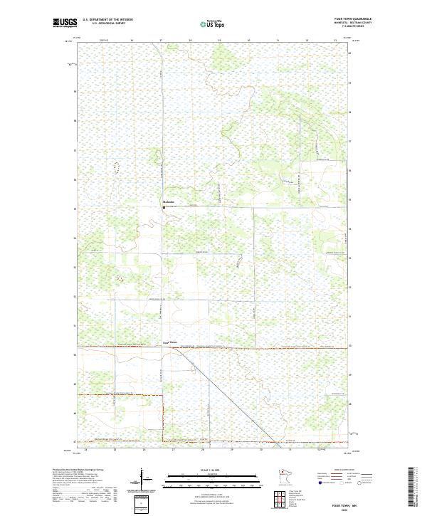
2022 Map of Four Town
USGS Topo · Published 2022About this map
Four Town and the neighboring settlement of Malcolm anchor this Beltrami County landscape, which is defined by a dense grid of wetlands and local roads. The area's history is reflected in several family-named thoroughfares, such as Tresselt Rd Nw, Jokela Rd Nw, and Dicks Parkway Rd. For genealogists, the Lone Oak Cem near Malcolm serves as a critical local landmark. The terrain is notably level, crisscrossed by the Fourtown-Grygla Trail System Trl, which winds through the extensive marshlands and woodlots. Evidence of past community infrastructure remains in labels like Grade School Rd Nw, while more recent recreational and residential development is visible along Sherwins Forest Rd Nw and Swedes Jackpine Rd Nw.
Find a feature on this map
32 named features on this map. Tap any name to fly to it.
Don’t see what you’re looking for? This feature index may not catch every label — zoom into the map to look around manually.
Map Details
Editions of this 2022 Four Town Map
This is the sole edition of this map. No revisions or reprints were ever made.
Other maps of this area

1918 · F
USGS Topo · 1:62,500

1918 · Malcolm
USGS Topo · 1:62,500

1918 · Jelle
USGS Topo · 1:62,500

1954 · Roseau
USGS Topo · 1:250,000

1957 · Roseau
USGS Topo · 1:250,000

1958 · Roseau
USGS Topo · 1:250,000

1973 · Gates Corner
USGS Topo · 1:24,000

1973 · Jelle NE
USGS Topo · 1:24,000

1973 · Thorhult
USGS Topo · 1:24,000
1973 · Shilling Dam NW
USGS Topo · 1:24,000