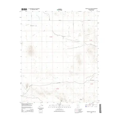
2014 Map of Fourth of July Butte
USGS Topo · Published 2014About this map
The Harquahala Plain defines the northern reaches of this landscape, where a grid of rural routes including W Dobbins Rd and S 491st Ave meet the desert floor. The terrain shifts dramatically to the south, dominated by the prominent volcanic landform of Fourth of July Butte and the high point at Dixie Peak. Drainage patterns across this arid basin are marked by the winding courses of Centennial Wash, Fourth of July Wash, and Quail Spring Wash. A handful of artificial landmarks, such as Galleto Tank, indicate the sparse water management required in this environment. The southern portion is navigated by W Agua Caliente Rd, tracing the base of the mountains through the townships of t2s r8w and t2s r7w.
Find a feature on this map
20 named features on this map. Tap any name to fly to it.
Don’t see what you’re looking for? This feature index may not catch every label — zoom into the map to look around manually.
Map Details
Editions of this 2014 Fourth of July Butte Map
This is the sole edition of this map. No revisions or reprints were ever made.
Other maps of this area

1942 · Vicksburg
USGS Topo · 1:250,000

1951 · Dendora Valley
USGS Topo · 1:62,500

1951 · Woolsey Peak
USGS Topo · 1:62,500

1954 · Phoenix
USGS Topo · 1:250,000

1957 · Phoenix
USGS Topo · 1:250,000

1958 · Phoenix
USGS Topo · 1:250,000

1960 · Phoenix
USGS Topo · 1:250,000

1962 · Cortez Peak
USGS Topo · 1:62,500

1962 · Arlington
USGS Topo · 1:62,500

1969 · Phoenix
USGS Topo · 1:250,000