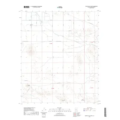
2018 Map of Fourth of July Butte
USGS Topo · Published 2018About this map
Harquahala Plain dominates this arid landscape, where the seasonal drainage of Centennial Wash cuts through the desert floor. The topography is defined by the prominent volcanic profile of Fourth of July Butte in the west and the high point of Dixie Peak to the south. A network of rural roads such as Aqua Caliente Rd and Arlington-Clanton Well Rd crisscross the section lines, reflecting the rectilinear surveying of the American West. The presence of W El Paso Natural Gas Rd highlights the modern energy infrastructure traversing these remote corridors. Smaller drainages like Fourth of July Wash and Quail Spring Wash offer a detailed look at the hydrology of Maricopa County, showing how water moves through this part of the Sonoran Desert during infrequent rains.
Find a feature on this map
20 named features on this map. Tap any name to fly to it.
Don’t see what you’re looking for? This feature index may not catch every label — zoom into the map to look around manually.
Map Details
Editions of this 2018 Fourth of July Butte Map
This is the sole edition of this map. No revisions or reprints were ever made.
Other maps of this area

1942 · Vicksburg
USGS Topo · 1:250,000

1951 · Dendora Valley
USGS Topo · 1:62,500

1951 · Woolsey Peak
USGS Topo · 1:62,500

1954 · Phoenix
USGS Topo · 1:250,000

1957 · Phoenix
USGS Topo · 1:250,000

1958 · Phoenix
USGS Topo · 1:250,000

1960 · Phoenix
USGS Topo · 1:250,000

1962 · Cortez Peak
USGS Topo · 1:62,500

1962 · Arlington
USGS Topo · 1:62,500

1969 · Phoenix
USGS Topo · 1:250,000