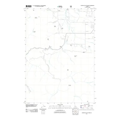
2011 Map of Fourth of July Peak
USGS Topo · Published 2011About this map
Fourth of July Peak dominates this Teton County landscape, where the high ridges of the Big Hole Mountains meet the agricultural irrigation networks of the valley. In the northern reaches, the small settlement of Cedron serves as a focal point near the winding Patterson Creek and Grove Creek, while the presence of the Humble Canal, Spencer Canal, and Tonks Canal illustrates the managed water systems critical to this Idaho region. The terrain is marked by significant elevation changes, from the depths of Drake Canyon and Wood Canyon to the heights of Squirrel Mountain. For those interested in historical land use, the Walton Mine sits near the northwestern corner, and the southern portion of the map is defined by the drainage basins of the North Fork Rainey Creek and South Fork Rainey Creek. Recreation and transit are concentrated along the corridor of Pine Creek Pass, featuring the Pine Creek Campground and access to Nat Forest Develop Road 231 Rd.
Find a feature on this map
48 named features on this map. Tap any name to fly to it.
Don’t see what you’re looking for? This feature index may not catch every label — zoom into the map to look around manually.
Map Details
Editions of this 2011 Fourth of July Peak Map
This is the sole edition of this map. No revisions or reprints were ever made.
Other maps of this area

1932 · Irwin
USGS Topo · 1:96,000

1935 · Irwin
USGS Topo · 1:125,000

1943 · Driggs
USGS Topo · 1:62,500

1943 · Garns Mtn
USGS Topo · 1:62,500

1946 · Driggs
USGS Topo · 1:62,500

1946 · Garns Mtn
USGS Topo · 1:62,500

1955 · Driggs
USGS Topo · 1:250,000

1958 · Driggs
USGS Topo · 1:250,000

1962 · Driggs
USGS Topo · 1:250,000
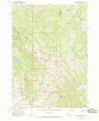
1966 · Palisades Peak
USGS Topo · 1:24,000