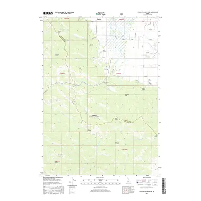
2017 Map of Fourth of July Peak
USGS Topo · Published 2017About this map
The Teton Basin dominates this 2017 survey, where the valley floor meets the eastern slopes of the Big Hole Mountains. The settlement of Victor sits at the edge of a complex irrigation network, evidenced by the Humble Canal, Spencer Canal, and Banks Canal that distribute water from the Teton River and its tributaries. To the west, the land rises sharply into the Targhee National Forest, a region defined by high-altitude landmarks such as Rocky Peak and the namesake Fourth of July Peak.
Find a feature on this map
75 named features on this map. Tap any name to fly to it.
Don’t see what you’re looking for? This feature index may not catch every label — zoom into the map to look around manually.
Map Details
Editions of this 2017 Fourth of July Peak Map
This is the sole edition of this map. No revisions or reprints were ever made.
Other maps of this area

1932 · Irwin
USGS Topo · 1:96,000

1935 · Irwin
USGS Topo · 1:125,000

1943 · Driggs
USGS Topo · 1:62,500

1943 · Garns Mtn
USGS Topo · 1:62,500

1946 · Driggs
USGS Topo · 1:62,500

1946 · Garns Mtn
USGS Topo · 1:62,500

1955 · Driggs
USGS Topo · 1:250,000

1958 · Driggs
USGS Topo · 1:250,000

1962 · Driggs
USGS Topo · 1:250,000
1966 · Palisades Peak
USGS Topo · 1:24,000