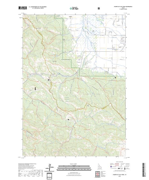
2024 Map of Fourth of July Peak
USGS Topo · Published 2024About this map
The town of Victor sits at the edge of the Teton Basin, where the agricultural lands of eastern Idaho meet the high terrain of the Targhee National Forest. This 2024 survey captures the geographic transition between the valley floor, irrigated by systems like the Humble Canal and Spencer Canal, and the high peaks of the Snake River Range. The map reveals a complex network of recreational and utility trails, including the Sheep Driveway Trl and Bpa Line Trl, which navigate the deep drainages of Wood Canyon and Allen Canyon. Notable summits such as Fourth of July Peak and Rocky Peak dominate the skyline, while the presence of a Fumarole north of the Snake River Range suggests the underlying geothermal character of the region. The map also delineates the Teton Co and Bonneville Co boundary as it traverses the Big Hole Mountains near Squirrel Mtn.
Find a feature on this map
96 named features on this map. Tap any name to fly to it.
Don’t see what you’re looking for? This feature index may not catch every label — zoom into the map to look around manually.
Map Details
Editions of this 2024 Fourth of July Peak Map
This is the sole edition of this map. No revisions or reprints were ever made.
Other maps of this area

1932 · Irwin
USGS Topo · 1:96,000

1935 · Irwin
USGS Topo · 1:125,000

1943 · Driggs
USGS Topo · 1:62,500

1943 · Garns Mtn
USGS Topo · 1:62,500

1946 · Driggs
USGS Topo · 1:62,500

1946 · Garns Mtn
USGS Topo · 1:62,500

1955 · Driggs
USGS Topo · 1:250,000

1958 · Driggs
USGS Topo · 1:250,000

1962 · Driggs
USGS Topo · 1:250,000
1966 · Palisades Peak
USGS Topo · 1:24,000