
1967 Map of Fowler Coulee NW
USGS Topo · Published 1971About this map
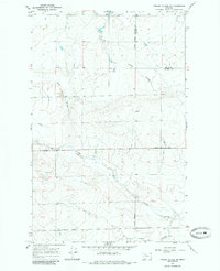
The rolling plains of north-central Montana are defined here by a series of drainage systems, most notably Fowler Coulee and Pondera Coulee. This 1967 field-checked survey illustrates a landscape primarily dedicated to agriculture and grazing, where transportation is dictated by the section line grid and the natural depressions of the terrain. Early infrastructure in the area is represented by Sollid Road and Midway Road, which traverse the county line dividing Pondera and Toole counties. A solitary Gravel Pit near Favot Coulee suggests localized material extraction for road building or maintenance. The map reveals the intricate network of ephemeral watercourses, including South Pondera Coulee, that shape the movement across this prairie environment.
Find a feature on this map
9 named features on this map. Tap any name to fly to it.
Don’t see what you’re looking for? This feature index may not catch every label — zoom into the map to look around manually.
Map Details
Editions of this 1967 Fowler Coulee NW Map
2 editions found
Other maps of this area

1920 · Conrad
USGS Topo · 1:125,000

1954 · Shelby
USGS Topo · 1:250,000

1958 · Shelby
USGS Topo · 1:250,000

1967 · Central School
USGS Topo · 1:24,000

1967 · Conrad Butte
USGS Topo · 1:24,000

1967 · Brady
USGS Topo · 1:24,000

1967 · Fowler Coulee SW
USGS Topo · 1:24,000
1967 · Letz Lake
USGS Topo · 1:24,000
1967 · Fowler Coulee SE
USGS Topo · 1:24,000
1967 · Fowler Coulee NE
USGS Topo · 1:24,000