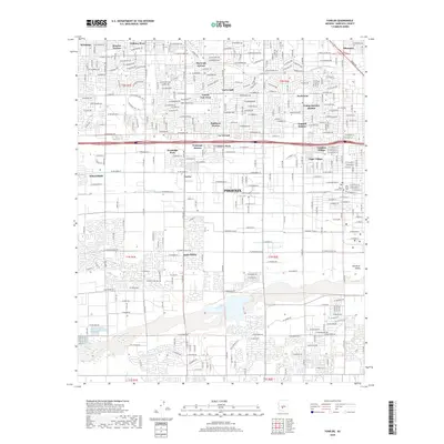
2018 Map of Fowler
USGS Topo · Published 2018About this map
The Salt River corridor south of Phoenix defines the landscape of this 2018 survey, where suburban expansion meets legacy irrigation infrastructure. The map reveals the dense residential patterning of West Valley neighborhoods like Maryvale Terrace and Alhambra, intersected by the vital Grand Canal and Roosevelt Canal. While much of the area is occupied by modern subdivisions such as Sunburst Homes and Young America Homes, historic anchors remain visible. Established communities like Tolleson and Fowler appear alongside significant local landmarks, including the Beth Israel Cem and Work Circle Cem. This map effectively documents the transition from agricultural roots to a fully integrated urban environment, capturing the varied character of districts like Santa Maria and Westridge Park near the river's path.
Find a feature on this map
111 named features on this map. Tap any name to fly to it.
Don’t see what you’re looking for? This feature index may not catch every label — zoom into the map to look around manually.
Map Details
Editions of this 2018 Fowler Map
This is the sole edition of this map. No revisions or reprints were ever made.
Other maps of this area

1912 · Phoenix
USGS Topo · 1:62,500

1914 · Phoenix
USGS Topo · 1:62,500

1946 · Avondale
USGS Topo · 1:62,500

1948 · Cashion
USGS Topo · 1:62,500

1952 · Lone Butte
USGS Topo · 1:24,000

1952 · Laveen
USGS Topo · 1:24,000

1952 · Phoenix
USGS Topo · 1:24,000

1952 · Fowler
USGS Topo · 1:24,000

1952 · Phoenix
USGS Topo · 1:62,500

1954 · Phoenix
USGS Topo · 1:250,000