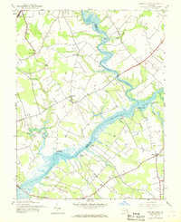
1944 Map of Fowling Creek
USGS Topo · Published 1968About this map
The Choptank River and its tributary, Tuckahoe Creek, define the landscape of this Maryland Eastern Shore region during the mid-1940s. The map captures a river-oriented economy where numerous historic wharves and landings, such as Ganey Wharf, Wings Landing, and Kingston Landing, serve as vital points of contact along the winding waterways separating Talbot and Caroline counties. These sites, along with Todd Wharf and McCarty Wharf, reflect the long-standing maritime heritage of the Chesapeake Bay watershed prior to the modern dominance of highway logistics.
Find a feature on this map
35 named features on this map. Tap any name to fly to it.
Don’t see what you’re looking for? This feature index may not catch every label — zoom into the map to look around manually.
Map Details
Editions of this 1944 Fowling Creek Map
4 editions found
Other maps of this area

1898 · Choptank
USGS Topo · 1:125,000

1904 · St. Michaels
USGS Topo · 1:62,500

1904 · Oxford
USGS Topo · 1:62,500

1905 · Denton
USGS Topo · 1:62,500

1905 · Hurlock
USGS Topo · 1:62,500

1908 · Choptank
USGS Topo · 1:125,000
1942 · Easton
USGS Topo · 1:24,000
1942 · Wye Mills
USGS Topo · 1:24,000
1942 · Trappe
USGS Topo · 1:24,000
1943 · Wye Mills
USGS Topo · 1:31,680