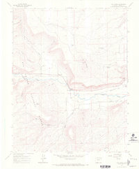
1967 Map of Fox Creek
USGS Topo · Published 1971About this map
Rio Grande National Forest dominates the southern reaches of this landscape, where the terrain drops toward the canyon of the Conejos River. The settlement of Las Mesitas serves as a focal point near the river's edge, characterized by its local Las Mesitas Ch and the Las Mesitas Cem. To the northwest, the smaller settlement of Fox Creek is marked by the Fox Creek Cem and proximity to its namesake waterway. The irrigation infrastructure, including the Las Mesitas Ditch and Canon Ditch, reveals the vital role of water management in this high-altitude environment. Engineering works like the D & R G W railroad and the Broyles Bridge facilitate movement through the river valley, while scattered landmarks such as Cold Springs and the Gaging Sta provide specific points of reference for those studying the mid-century geography of Conejos County.
Find a feature on this map
28 named features on this map. Tap any name to fly to it.
Don’t see what you’re looking for? This feature index may not catch every label — zoom into the map to look around manually.
Map Details
Editions of this 1967 Fox Creek Map
2 editions found
Other maps of this area

1918 · Tusas
USGS Topo · 1:125,000

1922 · Conejos
USGS Topo · 1:125,000

1945 · Durango
USGS Topo · 1:250,000

1953 · Durango
USGS Topo · 1:250,000

1954 · Durango
USGS Topo · 1:250,000

1954 · Aztec
USGS Topo · 1:250,000

1955 · Brazos Peak
USGS Topo · 1:62,500

1958 · Aztec
USGS Topo · 1:250,000

1961 · Durango
USGS Topo · 1:250,000

1962 · Aztec
USGS Topo · 1:250,000