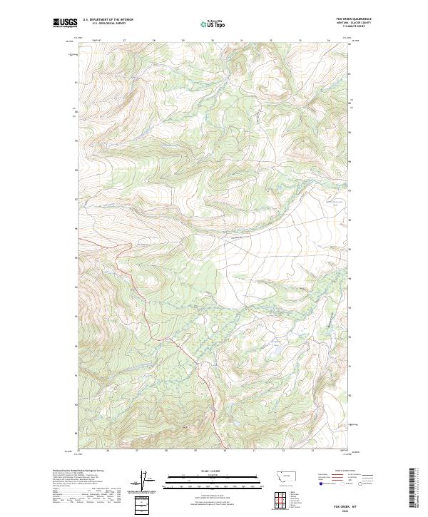
2024 Map of Fox Creek
USGS Topo · Published 2024About this map
The South Fork Milk River meanders across this high-country terrain, marking a landscape defined by significant elevation changes and remote water sources. In this 2024 edition, the hydrography is notably detailed, featuring named springs like 34N13W08BDDD01 Spring and 34N13W14DADC01 Spring that provide critical water points in the higher ridges. The geography is carved by steep drainages, including the descriptively named Madman Coulee and the valley of Livermore Creek. Settlement is minimal, with the area primarily accessed via the Fox Creek Trl and Livermore Creek Rd. This map captures a preserved wilderness character where natural landmarks like Josephine Lake and Toad Creek serve as the primary navigational anchors for those traversing the high basins near Fox Creek.
Find a feature on this map
16 named features on this map. Tap any name to fly to it.
Don’t see what you’re looking for? This feature index may not catch every label — zoom into the map to look around manually.
Map Details
Editions of this 2024 Fox Creek Map
This is the sole edition of this map. No revisions or reprints were ever made.
Other maps of this area

1901 · Browning
USGS Topo · 1:125,000

1903 · Browning
USGS Topo · 1:125,000

1960 · Cut Bank
USGS Topo · 1:250,000

1963 · Cut Bank
USGS Topo · 1:250,000

1964 · Cut Bank
USGS Topo · 1:250,000

1968 · Saint Mary
USGS Topo · 1:24,000

1968 · Babb
USGS Topo · 1:24,000

1968 · Josephine
USGS Topo · 1:24,000
1968 · Cut Bank Pass
USGS Topo · 1:24,000
1968 · Kiowa
USGS Topo · 1:24,000