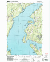
1997 Map of Fox Island
USGS Topo · Published 2003About this map
The complex shoreline of Carr Inlet and Hale Passage defines this portion of the Puget Sound, where tidal inlets and sand spits shape the local geography. In the late 20th century, the landscape is a mix of small coastal settlements like Rosedale and Arletta alongside specialized facilities such as the Naval Surface Warfare Center Fox Island Acoustic Laboratory on the northern tip of Fox Island.
Find a feature on this map
58 named features on this map. Tap any name to fly to it.
Don’t see what you’re looking for? This feature index may not catch every label — zoom into the map to look around manually.
Map Details
Editions of this 1997 Fox Island Map
This is the sole edition of this map. No revisions or reprints were ever made.
Other maps of this area

1937 · Olympia
USGS Topo · 1:62,500

1938 · Allyn
USGS Topo · 1:62,500

1940 · Anderson Island
USGS Topo · 1:62,500

1942 · Gig Harbor
USGS Topo · 1:62,500

1943 · Gig Harbor
USGS Topo · 1:62,500

1948 · Anderson Island
USGS Topo · 1:62,500

1948 · Anderson Island
USGS Topo · 1:24,000

1948 · Steilacoom
USGS Topo · 1:24,000

1949 · Olympia
USGS Topo · 1:62,500

1953 · Burley
USGS Topo · 1:24,000