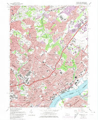
1967 Map of Frankford
USGS Topo · Published 1974About this map
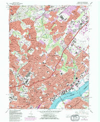
The Delaware River waterfront and the dense industrial and residential corridors of Northeast Philadelphia dominate this mid-century landscape. The Frankford Arsenal and the US Naval Supply Depot stand as massive anchors of the regional defense economy, while the Pennsylvania and New Jersey border is defined by the river's channel near Palmyra and Riverton. Residential expansion is evident in the sprawling neighborhoods of Bustleton, Fox Chase, and Frankford, punctuated by numerous parochial institutions like St Vincents Sch and Father Judge High Sch.
Find a feature on this map
142 named features on this map. Tap any name to fly to it.
Don’t see what you’re looking for? This feature index may not catch every label — zoom into the map to look around manually.
Map Details
Editions of this 1967 Frankford Map
5 editions found
Other maps of this area

1888 · Mount Holly
USGS Topo · 1:62,500

1890 · Burlington
USGS Topo · 1:62,500

1891 · Philadelphia
USGS Topo · 1:62,500

1893 · Germantown
USGS Topo · 1:62,500

1893 · Burlington
USGS Topo · 1:62,500

1894 · Mount Holly
USGS Topo · 1:62,500

1894 · Philadelphia
USGS Topo · 1:62,500

1894 · Germantown
USGS Topo · 1:62,500

1896 · Germantown
USGS Topo · 1:62,500

1896 · Philadelphia
USGS Topo · 1:62,500
Featured Places
- Philadelphia, PA
- Abington Township, PA
- Cheltenham Township, PA
- Cinnaminson Township, NJ
- Lower Moreland Township, PA