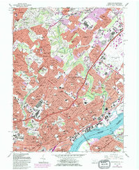
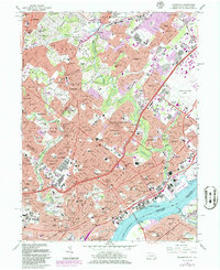
1967 Map of Frankford
USGS Topo · Published 1986About this map
Pennypack Creek and Tacony Creek wind through the dense urban and suburban landscape of Northeast Philadelphia and Lower Montgomery County during the mid-1960s. This survey documents the intense development surrounding arterial corridors like Roosevelt Boulevard and Oxford Ave, while preserving the locations of numerous institutional landmarks including Friends Hospital and the Jeanes Memorial Hospital. The map illustrates the transition from the established neighborhoods of Frankford and Tacony toward the burgeoning residential tracts in Bustleton and Somerton.
Find a feature on this map
142 named features on this map. Tap any name to fly to it.
Don’t see what you’re looking for? This feature index may not catch every label — zoom into the map to look around manually.
Map Details
Editions of this 1967 Frankford Map
5 editions found
Other maps of this area

1888 · Mount Holly
USGS Topo · 1:62,500

1890 · Burlington
USGS Topo · 1:62,500

1891 · Philadelphia
USGS Topo · 1:62,500

1893 · Germantown
USGS Topo · 1:62,500

1893 · Burlington
USGS Topo · 1:62,500

1894 · Mount Holly
USGS Topo · 1:62,500

1894 · Philadelphia
USGS Topo · 1:62,500

1894 · Germantown
USGS Topo · 1:62,500

1896 · Germantown
USGS Topo · 1:62,500

1896 · Philadelphia
USGS Topo · 1:62,500
Featured Places
- Philadelphia, PA
- Abington Township, PA
- Cheltenham Township, PA
- Cinnaminson Township, NJ
- Lower Moreland Township, PA