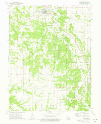
1973 Map of Frankford
USGS Topo · Published 1977About this map
Frankford serves as the primary hub of this northern Pike County landscape in the early 1970s, situated atop the ridge lines overlooking the wooded drainages of Peno Creek and Sugar Creek. The town plan is clearly visible, featuring a central cluster of buildings and a WT tower, while a nearby Quarry indicates local industrial activity. To the south and east, the map reveals a deeply etched topography of stream valleys, including Crooked Creek and Clifty Fork, which define the agricultural boundaries of the Spencer, Peno, and Cuivre townships.
Find a feature on this map
29 named features on this map. Tap any name to fly to it.
Don’t see what you’re looking for? This feature index may not catch every label — zoom into the map to look around manually.
Map Details
Editions of this 1973 Frankford Map
This is the sole edition of this map. No revisions or reprints were ever made.
Other maps of this area

1890 · Louisiana
USGS Topo · 1:125,000

1931 · Barry
USGS Topo · 1:62,500

1932 · Hannibal
USGS Topo · 1:62,500

1936 · Hannibal
USGS Topo · 1:48,000

1936 · Barry
USGS Topo · 1:48,000

1937 · Bowling Green
USGS Topo · 1:62,500

1940 · Bowling Green
USGS Topo · 1:62,500

1943 · Vandalia
USGS Topo · 1:62,500

1944 · Barry
USGS Topo · 1:62,500

1945 · Hannibal
USGS Topo · 1:62,500