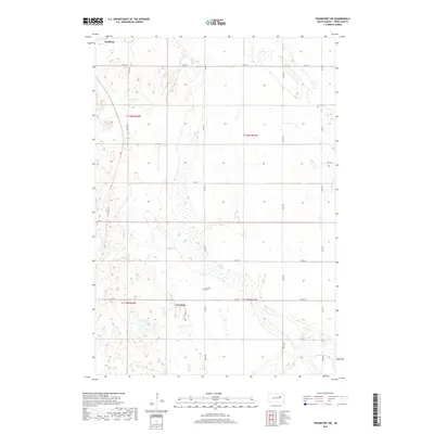
2017 Map of Frankfort SW
USGS Topo · Published 2017About this map
The outskirts of Redfield anchor the northwest corner of this Spink County landscape, where the prairie transitions into a complex network of seasonal wetlands and glacial depressions. This area, largely defined by its agricultural grid, shows the intersection of several local thoroughfares such as Co Rd 15 and Co Rd 22. A notable point of historical and genealogical interest is the Crandon Cem, located near the settlement of Crandon. The terrain is characterized by numerous small, unnamed water bodies and marshy areas that follow a north-south orientation, illustrating the typical drainage patterns of the James River Valley. The map also captures the precise boundaries of several townships, including t116n r64w and t116n r63w, providing a clear record of the Public Land Survey System as it existed in the late 2010s.
Find a feature on this map
19 named features on this map. Tap any name to fly to it.
Don’t see what you’re looking for? This feature index may not catch every label — zoom into the map to look around manually.
Map Details
Editions of this 2017 Frankfort SW Map
This is the sole edition of this map. No revisions or reprints were ever made.
Other maps of this area

1895 · Byron
USGS Topo · 1:125,000

1899 · Redfield
USGS Topo · 1:125,000

1953 · Frankfort
USGS Topo · 1:24,000

1953 · Redfield North
USGS Topo · 1:24,000

1953 · Ashton
USGS Topo · 1:24,000

1953 · Huron
USGS Topo · 1:250,000

1954 · Huron
USGS Topo · 1:250,000

1956 · Glendale Colony
USGS Topo · 1:24,000

1956 · Spink Colony
USGS Topo · 1:24,000

1966 · Redfield South
USGS Topo · 1:24,000