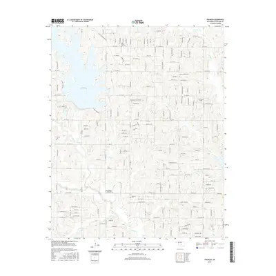
2016 Map of Franklin
USGS Topo · Published 2016About this map
Stanley Draper Lake dominates the northwestern landscape of this modern survey, its complex shoreline and surrounding recreational routes like E Lake Stanley Draper Dr defining the local geography. Further south, the settlement of Franklin sits at the junction of E Franklin Rd and S Westminster Rd, serving as a central point for the surrounding rural homesteads. The terrain is deeply etched by a network of waterways, including the Little River, Elm Creek, and Rock Creek, which drain the ridges and valleys of this part of Oklahoma and Cleveland Counties.
Find a feature on this map
151 named features on this map. Tap any name to fly to it.
Don’t see what you’re looking for? This feature index may not catch every label — zoom into the map to look around manually.
Map Details
Editions of this 2016 Franklin Map
This is the sole edition of this map. No revisions or reprints were ever made.
Other maps of this area

1892 · Moore
USGS Topo · 1:62,500

1893 · Norman
USGS Topo · 1:62,500

1898 · Purcell
USGS Topo · 1:125,000

1910 · McComb
USGS Topo · 1:62,500

1925 · Norman NO 2
USGS Topo · 1:24,000

1930 · McLoud
USGS Topo · 1:62,500

1934 · Crutcho Creek
USGS Topo · 1:24,000

1934 · Moore
USGS Topo · 1:62,500

1936 · Norman
USGS Topo · 1:62,500

1938 · Moore
USGS Topo · 1:62,500