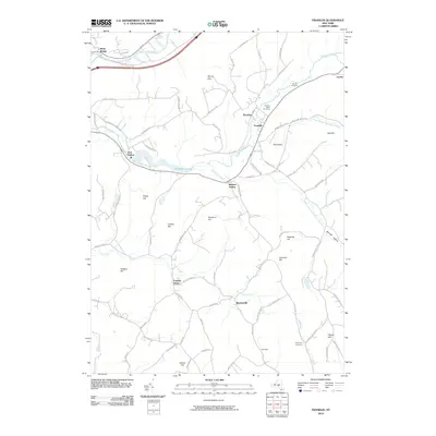
2010 Map of Franklin
USGS Topo · Published 2010About this map
Ouleout Creek and its many tributaries, including Handsome Brook and Carrs Creek, define the drainage patterns of this Delaware County landscape. The village of Franklin sits as a central hub, surrounded by smaller settlements like Brooklyn, Bartlett Hollow, and Merrickville. The northern reaches are bounded by the Susquehanna River, where Wells Bridge provides a key crossing point. This 2010 survey illustrates the persistence of small agricultural hamlets and crossroads, such as Franklin Depot and Leonta, long after the height of the region's dairy-driven economy.
Find a feature on this map
79 named features on this map. Tap any name to fly to it.
Don’t see what you’re looking for? This feature index may not catch every label — zoom into the map to look around manually.
Map Details
Editions of this 2010 Franklin Map
This is the sole edition of this map. No revisions or reprints were ever made.
Other maps of this area

1915 · Oneonta
USGS Topo · 1:62,500

1915 · Unadilla
USGS Topo · 1:62,500

1918 · Unadilla
USGS Topo · 1:62,500

1918 · Oneonta
USGS Topo · 1:62,500

1923 · Walton
USGS Topo · 1:48,000

1924 · Deposit
USGS Topo · 1:62,500

1925 · Walton
USGS Topo · 1:62,500

1926 · Deposit
USGS Topo · 1:62,500

1943 · Gilbertsville
USGS Topo · 1:24,000

1943 · Franklin
USGS Topo · 1:24,000