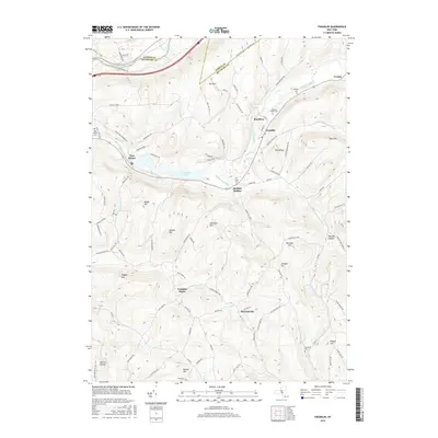
2016 Map of Franklin
USGS Topo · Published 2016About this map
Ouleout Creek meanders through the central valley of this Delaware County landscape, connecting the clustered settlements of Brooklyn and Franklin. The terrain is defined by a series of prominent rises including Mt Zion, Oak Hill, and Sherman Hill, which separate the various branches of Handsome Brook and Carrs Cr. In the northwest corner, the Susquehanna River cuts a distinct path near the border of Otsego County, while E Sidney Lake provides a significant water feature just west of Bartlett Hollow. Genealogists will find a wealth of local history in the numerous burial grounds scattered across the townships, such as Ouleout Valley Cem, East Sidney Cem, and the Plymouth Cem located near W Brook. The map also preserves the locations of rural hamlets and transit points like Franklin Depot and Merrickville, reflecting the area's long-standing agricultural and transport networks.
Find a feature on this map
103 named features on this map. Tap any name to fly to it.
Don’t see what you’re looking for? This feature index may not catch every label — zoom into the map to look around manually.
Map Details
Editions of this 2016 Franklin Map
This is the sole edition of this map. No revisions or reprints were ever made.
Other maps of this area

1915 · Oneonta
USGS Topo · 1:62,500

1915 · Unadilla
USGS Topo · 1:62,500

1918 · Unadilla
USGS Topo · 1:62,500

1918 · Oneonta
USGS Topo · 1:62,500

1923 · Walton
USGS Topo · 1:48,000

1924 · Deposit
USGS Topo · 1:62,500

1925 · Walton
USGS Topo · 1:62,500

1926 · Deposit
USGS Topo · 1:62,500

1943 · Gilbertsville
USGS Topo · 1:24,000

1943 · Franklin
USGS Topo · 1:24,000