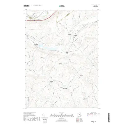
2019 Map of Franklin
USGS Topo · Published 2019About this map
Ouleout Creek and its many branches, including the W Br Ouleout Cr, carve a complex drainage pattern through the highlands of Delaware and Otsego Counties. The village of Franklin serves as a primary hub, while smaller hamlets like East Sidney, Merrickville, and Bartlett Hollow are tucked into the valleys. For genealogists, the map is a significant record of burial sites, identifying East Sidney Cem, Barnes Cem, and the Plymouth Community Church Cem. The landscape is dominated by named summits such as Wheat Hill, Sherman Hill, and Mt Zion. The presence of Franklin Depot alludes to the region's historic transportation corridors, while the East Sidney Lake reservoir represents a significant modern modification of the Ouleout Creek watershed. The Susquehanna River flows across the northern edge near Wells Bridge, where I-88 follows the river valley.
Find a feature on this map
103 named features on this map. Tap any name to fly to it.
Don’t see what you’re looking for? This feature index may not catch every label — zoom into the map to look around manually.
Map Details
Editions of this 2019 Franklin Map
This is the sole edition of this map. No revisions or reprints were ever made.
Other maps of this area

1915 · Oneonta
USGS Topo · 1:62,500

1915 · Unadilla
USGS Topo · 1:62,500

1918 · Unadilla
USGS Topo · 1:62,500

1918 · Oneonta
USGS Topo · 1:62,500

1923 · Walton
USGS Topo · 1:48,000

1924 · Deposit
USGS Topo · 1:62,500

1925 · Walton
USGS Topo · 1:62,500

1926 · Deposit
USGS Topo · 1:62,500

1943 · Gilbertsville
USGS Topo · 1:24,000

1943 · Franklin
USGS Topo · 1:24,000