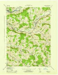
1945 Map of Franklin
USGS Topo · Published 1945About this map
Franklin serves as the central hub of this mid-1940s landscape, positioned where the East Branch Ouleout Creek joins Ouleout Creek. The village is a concentrated point of settlement surrounded by a network of upland farms and rural schools, including School No 4 and School No 16. The New York Ontario and Western Railroad snakes through the southern hills, connecting remote stops like Franklin Depot, Merrickville, and the Woodford Northfield Station.
Find a feature on this map
43 named features on this map. Tap any name to fly to it.
Don’t see what you’re looking for? This feature index may not catch every label — zoom into the map to look around manually.
Map Details
Editions of this 1945 Franklin Map
This is the sole edition of this map. No revisions or reprints were ever made.
Other maps of this area

1915 · Oneonta
USGS Topo · 1:62,500

1915 · Unadilla
USGS Topo · 1:62,500

1918 · Unadilla
USGS Topo · 1:62,500

1918 · Oneonta
USGS Topo · 1:62,500

1923 · Walton
USGS Topo · 1:48,000

1924 · Deposit
USGS Topo · 1:62,500

1925 · Walton
USGS Topo · 1:62,500

1926 · Deposit
USGS Topo · 1:62,500

1943 · Gilbertsville
USGS Topo · 1:24,000

1943 · Franklin
USGS Topo · 1:24,000