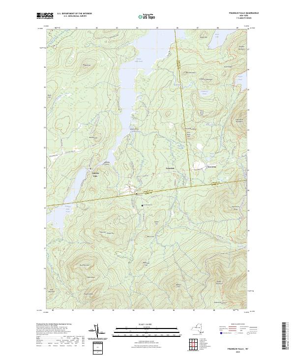
2023 Map of Franklin Falls
USGS Topo · Published 2023About this map
Union Falls Pond and the surrounding Adirondack Park Preserve dominate this high-country landscape, where the borders of Franklin, Clinton, and Essex counties converge. The small settlement of Franklin Falls sits near the head of Franklin Falls Pond, a region defined by its reliance on water power and timber in previous centuries. Further east, the hamlets of Forestdale and West Kilns are situated along the Forestdale Rd corridor, providing a glimpse into the historic cluster of charcoal and iron-related industries that once characterized the area.
Find a feature on this map
75 named features on this map. Tap any name to fly to it.
Don’t see what you’re looking for? This feature index may not catch every label — zoom into the map to look around manually.
Map Details
Editions of this 2023 Franklin Falls Map
This is the sole edition of this map. No revisions or reprints were ever made.
Other maps of this area

1896 · Lake Placid
USGS Topo · 1:62,500

1898 · Lake Placid
USGS Topo · 1:62,500

1902 · Saranac
USGS Topo · 1:62,500

1904 · Saranac
USGS Topo · 1:62,500

1906 · Loon Lake
USGS Topo · 1:62,500

1908 · Loon Lake
USGS Topo · 1:62,500

1911 · Lyon Mountain
USGS Topo · 1:62,500

1913 · Lyon Mountain
USGS Topo · 1:62,500

1931 · Lyon Mountain
USGS Topo · 1:62,500

1948 · Ogdensburg
USGS Topo · 1:250,000