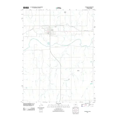
2011 Map of Franklin
USGS Topo · Published 2011About this map
Franklin serves as the central hub of this Nebraska landscape, situated just north of the wide Republican River. The town's grid is detailed with specific street names like P St, K St, and 20th Avenue St, while the Franklin Post Office and Greenwood Cemetery provide anchor points for local genealogical research. North of the city, the Franklins Plainview Airport sits near the headwaters of Coon Creek and Walnut Run.
Find a feature on this map
34 named features on this map. Tap any name to fly to it.
Don’t see what you’re looking for? This feature index may not catch every label — zoom into the map to look around manually.
Map Details
Editions of this 2011 Franklin Map
This is the sole edition of this map. No revisions or reprints were ever made.
Other maps of this area

1893 · Smith Center
USGS Topo · 1:125,000

1893 · Phillipsburg
USGS Topo · 1:125,000

1896 · Holdrege
USGS Topo · 1:125,000

1897 · Red Cloud
USGS Topo · 1:125,000

1955 · Grand Island
USGS Topo · 1:250,000

1955 · Beloit
USGS Topo · 1:250,000

1957 · Grand Island
USGS Topo · 1:250,000

1958 · Grand Island
USGS Topo · 1:250,000

1959 · Beloit
USGS Topo · 1:250,000

1973 · Kensington NE
USGS Topo · 1:24,000