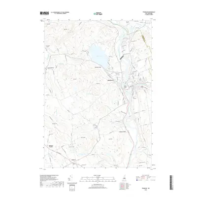
2018 Map of Franklin
USGS Topo · Published 2018About this map
The confluence of the Pemigewasset River and the Winnipesaukee River forms the headwaters of the Merrimack River at Franklin, a geography that historically powered the region's industrial growth. This 2018 survey detail shows the city's relationship with Webster Lake and the varied terrain of hills like Raccoon Hill and Searles Hill. The landscape is dotted with ancestral landmarks, including numerous small burial grounds such as Shaw Corner Cem and the Holy Cross Cem. Local infrastructure is anchored by the historic Daniel Webster Bridge and the Sulphite Bridge crossing the river channels. The map also traces the rural character of neighboring Salisbury and East Andover, where landmarks like the Tucker Farm Airport and Weeks Pond define the transition from town centers to the granite-underlaid hills of Merrimack County.
Find a feature on this map
114 named features on this map. Tap any name to fly to it.
Don’t see what you’re looking for? This feature index may not catch every label — zoom into the map to look around manually.
Map Details
Editions of this 2018 Franklin Map
This is the sole edition of this map. No revisions or reprints were ever made.
Other maps of this area

1925 · Holderness
USGS Topo · 1:62,500

1927 · Penacook
USGS Topo · 1:62,500

1927 · Holderness
USGS Topo · 1:62,500

1927 · Cardigan
USGS Topo · 1:62,500

1928 · Mount Kearsarge
USGS Topo · 1:62,500

1930 · Cardigan
USGS Topo · 1:62,500

1931 · Mount Kearsarge
USGS Topo · 1:62,500

1949 · Portland
USGS Topo · 1:250,000

1956 · Cardigan
USGS Topo · 1:62,500

1956 · Penacook
USGS Topo · 1:62,500