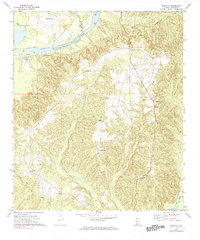
1972 Map of Franklin
USGS Topo · Published 1984About this map
The Alabama River winds through the northern reach of this Monroe County landscape, defining a terrain of deep creek valleys and remote settlements during the early 1970s. The community of Franklin serves as a local hub, while the oddly named Scratch Ankle sits further south among the drainages of Bradley Mill Creek and Holly Mill Creek. For genealogists, the map is a dense record of rural life, locating numerous family and community landmarks such as Eureka Cem, Mt Ararat Cem, and York Cem.
Find a feature on this map
24 named features on this map. Tap any name to fly to it.
Don’t see what you’re looking for? This feature index may not catch every label — zoom into the map to look around manually.
Map Details
Editions of this 1972 Franklin Map
2 editions found
Other maps of this area

1953 · Andalusia
USGS Topo · 1:250,000

1957 · Andalusia
USGS Topo · 1:250,000

1972 · Monroeville
USGS Topo · 1:24,000

1972 · Natchez
USGS Topo · 1:24,000

1972 · Franklin
USGS Topo · 1:24,000

1972 · Mexia
USGS Topo · 1:24,000

1972 · Claiborne
USGS Topo · 1:24,000

1972 · Chance
USGS Topo · 1:24,000

1973 · Hybart
USGS Topo · 1:24,000

1973 · Lower Peach Tree
USGS Topo · 1:24,000