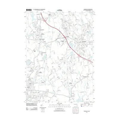
2012 Map of Franklin
USGS Topo · Published 2012About this map
Bellingham and Franklin anchor this regional survey of the Massachusetts and Rhode Island borderlands, where the Charles River winds through a landscape defined by glacial hills and numerous small ponds. The 2012 data shows a complex pattern of suburban growth centered on the intersection of I-495 and local routes like Ma 140, while preserving local heritage in the form of numerous historic burial grounds. Genealogists and local historians can find Ballou Cem and the nearby Elder Ballou Mtg House Rd, which point to the area’s early Quaker and religious history. The map captures the transition from the concentrated campus of Dean Junior College to the outlying rural settlements of Sheldonville and Burnt Swamp Corner. Prominent topographical features such as Pigeon Hill and Forge Hill rise above the drainage basins of the Peters River and Miscoe Brook, illustrating the varied terrain of the Norfolk and Providence County border.
Find a feature on this map
94 named features on this map. Tap any name to fly to it.
Don’t see what you’re looking for? This feature index may not catch every label — zoom into the map to look around manually.
Map Details
Editions of this 2012 Franklin Map
This is the sole edition of this map. No revisions or reprints were ever made.
Other maps of this area

1886 · Blackstone
USGS Topo · 1:62,500

1887 · Franklin
USGS Topo · 1:62,500

1887 · Providence
USGS Topo · 1:62,500

1889 · Providence
USGS Topo · 1:62,500

1889 · Blackstone
USGS Topo · 1:62,500

1889 · Franklin
USGS Topo · 1:62,500

1889 · Burrillville
USGS Topo · 1:62,500

1893 · Franklin
USGS Topo · 1:62,500

1893 · Blackstone
USGS Topo · 1:62,500

1894 · Burrillville
USGS Topo · 1:62,500