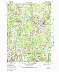
1965 Map of Franklin
USGS Topo · Published 1979About this map
Bellingham and the industrial edge of Woonsocket anchor this survey of the Massachusetts and Rhode Island borderlands during the mid-1960s, updated with suburban expansion through the late 1970s. The landscape transitions from the dense urban grid in the south to the wooded tracts of Franklin State Forest and Diamond Hill State Park. A robust educational and religious presence is evident through landmarks such as Dean Junior College, Mount Saint Charles Academy, and the St Marys Abbey.
Find a feature on this map
109 named features on this map. Tap any name to fly to it.
Don’t see what you’re looking for? This feature index may not catch every label — zoom into the map to look around manually.
Map Details
Editions of this 1965 Franklin Map
This is the sole edition of this map. No revisions or reprints were ever made.
Other maps of this area

1886 · Blackstone
USGS Topo · 1:62,500

1887 · Franklin
USGS Topo · 1:62,500

1887 · Providence
USGS Topo · 1:62,500

1889 · Providence
USGS Topo · 1:62,500

1889 · Blackstone
USGS Topo · 1:62,500

1889 · Franklin
USGS Topo · 1:62,500
1889 · Burrillville
USGS Topo · 1:62,500

1893 · Franklin
USGS Topo · 1:62,500
1893 · Blackstone
USGS Topo · 1:62,500
1894 · Burrillville
USGS Topo · 1:62,500