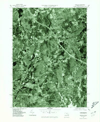
1977 Map of Franklin
USGS Topo · Published 1981About this map
Franklin and the surrounding Norfolk County landscape appear here in a specialized orthophotoquad format, providing a photographic record of the region's late-1970s development. The imagery highlights the dense residential expansion radiating from centers like Bellingham and North Bellingham, contrasted against the significant forested tracts that remained in the southern portion of the quadrangle. Transport corridors are clearly visible, cutting through the terrain to connect Unionville with the larger metropolitan fringe.
Find a feature on this map
8 named features on this map. Tap any name to fly to it.
Don’t see what you’re looking for? This feature index may not catch every label — zoom into the map to look around manually.
Map Details
Editions of this 1977 Franklin Map
This is the sole edition of this map. No revisions or reprints were ever made.
Other maps of this area

1886 · Blackstone
USGS Topo · 1:62,500

1887 · Franklin
USGS Topo · 1:62,500

1887 · Providence
USGS Topo · 1:62,500

1889 · Providence
USGS Topo · 1:62,500

1889 · Blackstone
USGS Topo · 1:62,500

1889 · Franklin
USGS Topo · 1:62,500

1889 · Burrillville
USGS Topo · 1:62,500

1893 · Franklin
USGS Topo · 1:62,500

1893 · Blackstone
USGS Topo · 1:62,500

1894 · Burrillville
USGS Topo · 1:62,500