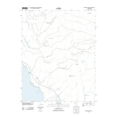
2012 Map of Franklin Point
USGS Topo · Published 2012About this map
Butano Park and the rugged coastal interface of San Mateo County define this 2012 survey. The landscape is characterized by a series of deep canyons and ridges, where Butano Cr and its various forks flow toward the Pacific Ocean. A significant portion of the interior is dedicated to recreation and preservation, with Big Basin Redwoods State Park encompassing much of the eastern terrain. Numerous campgrounds and landmarks like Whitehouse Camp and Chalks Lookout suggest a long-standing history of forestry and outdoor access.
Find a feature on this map
51 named features on this map. Tap any name to fly to it.
Don’t see what you’re looking for? This feature index may not catch every label — zoom into the map to look around manually.
Map Details
Editions of this 2012 Franklin Point Map
This is the sole edition of this map. No revisions or reprints were ever made.
Other maps of this area

1897 · Palo Alto
USGS Topo · 1:62,500

1899 · Palo Alto
USGS Topo · 1:62,500

1902 · Santa Cruz
USGS Topo · 1:125,000

1940 · Halfmoon Bay
USGS Topo · 1:62,500

1940 · Ano Nuevo
USGS Topo · 1:62,500

1941 · Ano Nuevo Pt.
USGS Topo · 1:62,500

1941 · Palo Alto
USGS Topo · 1:62,500

1942 · Ano Nuevo
USGS Topo · 1:62,500

1943 · Palo Alto
USGS Topo · 1:62,500

1943 · Halfmoon Bay
USGS Topo · 1:62,500