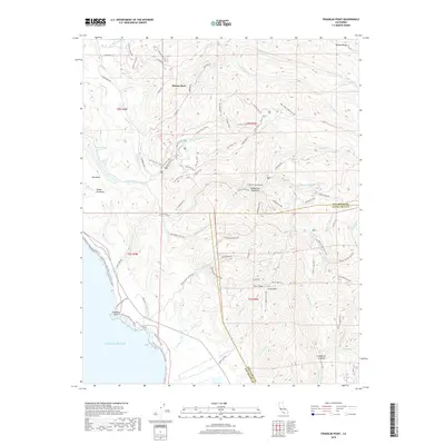
2018 Map of Franklin Point
USGS Topo · Published 2018About this map
Butano Park and the northern reaches of the Santa Cruz Mountains dominate this coastal survey along the Pacific Ocean. The landscape is defined by a dense network of watercourses and fire roads, where Butano Creek and its southern fork carve through deep canyons near Butano Falls. The boundary between San Mateo County and Santa Cruz County bisects the terrain, crossing the upper reaches of Gazos Creek and Whitehouse Creek.
Find a feature on this map
84 named features on this map. Tap any name to fly to it.
Don’t see what you’re looking for? This feature index may not catch every label — zoom into the map to look around manually.
Map Details
Editions of this 2018 Franklin Point Map
This is the sole edition of this map. No revisions or reprints were ever made.
Other maps of this area

1897 · Palo Alto
USGS Topo · 1:62,500

1899 · Palo Alto
USGS Topo · 1:62,500

1902 · Santa Cruz
USGS Topo · 1:125,000

1940 · Halfmoon Bay
USGS Topo · 1:62,500

1940 · Ano Nuevo
USGS Topo · 1:62,500

1941 · Ano Nuevo Pt.
USGS Topo · 1:62,500

1941 · Palo Alto
USGS Topo · 1:62,500

1942 · Ano Nuevo
USGS Topo · 1:62,500

1943 · Palo Alto
USGS Topo · 1:62,500

1943 · Halfmoon Bay
USGS Topo · 1:62,500