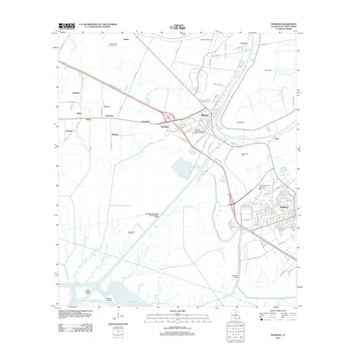
2012 Map of Franklin
USGS Topo · Published 2012About this map
Bayou Teche winds through the heart of St. Mary Parish, anchoring a landscape where sugar cane heritage and modern industry meet. This 2012 survey details the city of Franklin and the town of Baldwin, illustrating how the region's transport network is defined by both historical waterways and contemporary infrastructure. The map documents numerous smaller settlements and named locales like Gold Mine, Choupique, and Adeline, which point to the area's agricultural and resource-driven history.
Find a feature on this map
116 named features on this map. Tap any name to fly to it.
Don’t see what you’re looking for? This feature index may not catch every label — zoom into the map to look around manually.
Map Details
Editions of this 2012 Franklin Map
This is the sole edition of this map. No revisions or reprints were ever made.
Other maps of this area

1937 · Bayou Sale
USGS Topo · 1:62,500

1937 · Jeanerette
USGS Topo · 1:62,500

1941 · Belle Isle
USGS Topo · 1:62,500

1945 · New Orleans
USGS Topo · 1:250,000

1948 · Foster
USGS Topo · 1:62,500

1954 · Jeanerette
USGS Topo · 1:62,500

1954 · Belle Isle
USGS Topo · 1:62,500

1957 · Bayou Sale
USGS Topo · 1:62,500

1959 · Foster
USGS Topo · 1:62,500

1963 · New Orleans
USGS Topo · 1:250,000