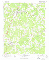
1978 Map of Franklinton
USGS Topo · Published 1978About this map
The town of Franklinton serves as a central hub in this northern Piedmont landscape, where the Scl railroad corridor shapes the local geography. The rail line runs parallel to established settlements, connecting the main village with Youngsville to the south. This 1970s survey captures a community deeply rooted in its local institutions, evidenced by the numerous small rural churches like Manassa Ch, Ebenezer Ch, and Flat Rock Ch that dot the countryside. Significant infrastructure for the era is visible, including the Franklinton Reservoir, the municipal Filtration Plant, and the Sewage Disposal facility located south of the main town center.
Find a feature on this map
39 named features on this map. Tap any name to fly to it.
Don’t see what you’re looking for? This feature index may not catch every label — zoom into the map to look around manually.
Map Details
Editions of this 1978 Franklinton Map
2 editions found
Other maps of this area

1943 · Raleigh
USGS Topo · 1:62,500

1943 · Creedmoor
USGS Topo · 1:62,500

1944 · Creedmoor
USGS Topo · 1:62,500

1951 · Raleigh
USGS Topo · 1:62,500

1953 · Raleigh
USGS Topo · 1:250,000

1953 · Greensboro
USGS Topo · 1:250,000

1954 · Greensboro
USGS Topo · 1:250,000

1954 · Raleigh
USGS Topo · 1:250,000

1962 · Greensboro
USGS Topo · 1:250,000

1966 · Greensboro
USGS Topo · 1:250,000