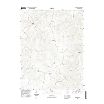
2016 Map of Franklinton
USGS Topo · Published 2016About this map
Bethlehem and Franklinton anchor this central Henry County landscape, where the terrain is deeply etched by a network of waterways including Drennon Creek and the Salt River. The topography is defined by high ground like James Ridge and Happy Ridge, which dictated the winding paths of local roads such as Bullitt Hill Rd and Point Pleasant Rd. For genealogists, the map preserves the exact locations of family-named burial grounds like Jenkins Cem, Sewell Cem, and Willhite Cem, alongside smaller settlements like Delville and Slabtown. The drainage patterns, including Holy Water Branch and Petrole Branch Salt River, illustrate the complex watershed that has shaped agricultural and residential development in this part of Kentucky.
Find a feature on this map
63 named features on this map. Tap any name to fly to it.
Don’t see what you’re looking for? This feature index may not catch every label — zoom into the map to look around manually.
Map Details
Editions of this 2016 Franklinton Map
This is the sole edition of this map. No revisions or reprints were ever made.
Other maps of this area

1906 · Lockport
USGS Topo · 1:48,000

1908 · Lockport
USGS Topo · 1:62,500

1928 · New Castle
USGS Topo · 1:48,000

1932 · New Castle
USGS Topo · 1:62,500

1950 · New Liberty
USGS Topo · 1:24,000

1952 · Worthville
USGS Topo · 1:24,000

1952 · Campbellsburg
USGS Topo · 1:24,000

1953 · Gratz
USGS Topo · 1:24,000

1953 · Polsgrove
USGS Topo · 1:24,000
1954 · New Castle
USGS Topo · 1:24,000