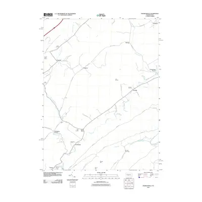
2010 Map of Franklinville
USGS Topo · Published 2010About this map
Huntingdon Furnace and Pennsylvania Furnace anchor this landscape, reflecting the central Pennsylvania iron heritage. The terrain is defined by the winding course of Spruce Creek and its many tributaries, including Warriors Mark Run and Globe Run. Small rural communities such as Franklinville, Seven Stars, and Graysville are scattered across the valley, each preserved with its own local burying ground like Seven Stars Cemetery and Franklinville Cemetery. A distinct shift in land use is visible near The Barrens, while technical features like Grazier Mill and the Russell Farms Airport indicate the area's agricultural and industrial evolution. High points like Round Top and Indian Lookout overlook a network of local routes, including the prominent Brady Rd and the remnants of the Tram Rd.
Find a feature on this map
58 named features on this map. Tap any name to fly to it.
Don’t see what you’re looking for? This feature index may not catch every label — zoom into the map to look around manually.
Map Details
Editions of this 2010 Franklinville Map
This is the sole edition of this map. No revisions or reprints were ever made.
Other maps of this area

1908 · Bellefonte
USGS Topo · 1:62,500

1909 · Bellefonte
USGS Topo · 1:62,500

1919 · Menno
USGS Topo · 1:62,500

1922 · Philipsburg
USGS Topo · 1:62,500

1923 · Tyrone
USGS Topo · 1:62,500

1929 · Tyrone
USGS Topo · 1:48,000

1933 · Tyrone
USGS Topo · 1:62,500

1935 · Allensville
USGS Topo · 1:62,500

1938 · Allensville
USGS Topo · 1:62,500

1939 · Philipsburg
USGS Topo · 1:62,500
Featured Places
- Warriors Mark Township, PA
- Spruce Creek Township, PA
- Centre Line, PA
- Franklinville, Franklin Township
- Dungarvin, Warriors Mark Township