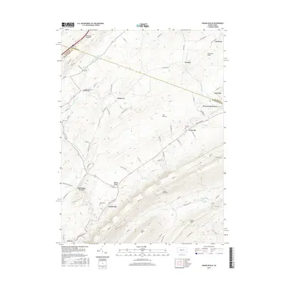
2016 Map of Franklinville
USGS Topo · Published 2016About this map
Pennsylvania Furnace and Huntingdon Furnace stand as markers of the historic iron industry that once dominated this region of the Centre and Huntingdon county line. The landscape is defined by the parallel ridges of Bald Eagle Mountain and Tussey Mountain, with the fertile valley between them supporting a network of small settlements like Franklinville and Graysville. These communities are often centered near water sources such as Spruce Cr or along early transport routes like Dry Hollow Rd. Genealogists will find a wealth of local family history in the numerous small burial grounds scattered across the township, including Spittler Cem, Funk Cem, and the Seven Stars Cem. The terrain south of Gatesburg Ridge known as The Barrens offers a contrast to the settled valley floors, illustrating the varying land use patterns in this part of Pennsylvania's ridge and valley province.
Find a feature on this map
77 named features on this map. Tap any name to fly to it.
Don’t see what you’re looking for? This feature index may not catch every label — zoom into the map to look around manually.
Map Details
Editions of this 2016 Franklinville Map
This is the sole edition of this map. No revisions or reprints were ever made.
Other maps of this area

1908 · Bellefonte
USGS Topo · 1:62,500

1909 · Bellefonte
USGS Topo · 1:62,500

1919 · Menno
USGS Topo · 1:62,500

1922 · Philipsburg
USGS Topo · 1:62,500

1923 · Tyrone
USGS Topo · 1:62,500

1929 · Tyrone
USGS Topo · 1:48,000

1933 · Tyrone
USGS Topo · 1:62,500

1935 · Allensville
USGS Topo · 1:62,500

1938 · Allensville
USGS Topo · 1:62,500

1939 · Philipsburg
USGS Topo · 1:62,500
Featured Places
- Warriors Mark Township, PA
- Spruce Creek Township, PA
- Centre Line, PA
- Franklinville, Franklin Township
- Dungarvin, Warriors Mark Township