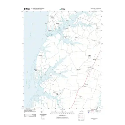
2011 Map of Franktown
USGS Topo · Published 2011About this map
Franktown and the surrounding neck lands of Northampton County are defined by a complex interface of salt marshes and tidal creeks along the Chesapeake Bay. The early 21st-century landscape maintains a rural character, where small settlements like Birdsnest and Machipongo are linked by the corridor between the bay and the sea. The map reveals a pattern of coastal development ranging from established communities such as Bridgetown to newer residential enclaves like Peaceful Beach Estates and Cardinal Estates.
Find a feature on this map
51 named features on this map. Tap any name to fly to it.
Don’t see what you’re looking for? This feature index may not catch every label — zoom into the map to look around manually.
Map Details
Editions of this 2011 Franktown Map
This is the sole edition of this map. No revisions or reprints were ever made.
Other maps of this area

1942 · Cheriton
USGS Topo · 1:24,000

1942 · Cobb Island
USGS Topo · 1:24,000

1942 · Nassawadox
USGS Topo · 1:24,000

1943 · Nassawadox
USGS Topo · 1:31,680

1943 · Jamesville
USGS Topo · 1:31,680

1943 · Franktown
USGS Topo · 1:31,680

1943 · Exmore
USGS Topo · 1:24,000

1943 · Richmond
USGS Topo · 1:250,000

1944 · Exmore
USGS Topo · 1:31,680

1946 · Eastville
USGS Topo · 1:250,000