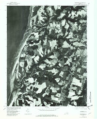
1977 Map of Franktown
USGS Topo · Published 1982About this map
Nassawadox Creek and Hungars Creek carve deep into the Northampton County landscape, defining the character of Virginia's Eastern Shore during the late 1970s. This orthophotoquad, produced by the Geological Survey in cooperation with the Soil Conservation Service, uses rectified aerial imagery to show the intricate patchwork of agricultural fields and woodlands that separate the bayside settlements. From the northern reaches of Franktown to the southern waters of Mattawoman Creek, the map provides a clear view of the rural road networks and coastal developments like Silver Beach. The placement of Bridgetown, Johnsontown, Treherneville, and Machipongo illustrates the traditional settlement pattern of the peninsula, where small communities established themselves along inland thoroughfares and at the heads of navigable creeks leading to the Chesapeake Bay.
Find a feature on this map
10 named features on this map. Tap any name to fly to it.
Don’t see what you’re looking for? This feature index may not catch every label — zoom into the map to look around manually.
Map Details
Editions of this 1977 Franktown Map
This is the sole edition of this map. No revisions or reprints were ever made.
Other maps of this area

1942 · Cheriton
USGS Topo · 1:24,000

1942 · Cobb Island
USGS Topo · 1:24,000

1942 · Nassawadox
USGS Topo · 1:24,000

1943 · Nassawadox
USGS Topo · 1:31,680

1943 · Jamesville
USGS Topo · 1:31,680

1943 · Franktown
USGS Topo · 1:31,680

1943 · Exmore
USGS Topo · 1:24,000

1943 · Richmond
USGS Topo · 1:250,000

1944 · Exmore
USGS Topo · 1:31,680

1946 · Eastville
USGS Topo · 1:250,000