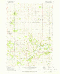
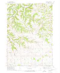
1971 Map of Frankville
USGS Topo · Published 1973About this map
The Yellow River and its North Fork Yellow River carve a deep course through this section of Allamakee and Winneshiek counties, defining the agricultural and industrial landscape of the early 1970s. The settlement of Frankville sits in the southwest, while Ludlow occupies the northern reaches of the quadrangle. Local limestone extraction is evident through numerous Quarries dotting the hillsides, particularly near the river bends and the Ludlow township line.
Find a feature on this map
20 named features on this map. Tap any name to fly to it.
Don’t see what you’re looking for? This feature index may not catch every label — zoom into the map to look around manually.
Map Details
Editions of this 1971 Frankville Map
This is the sole edition of this map. No revisions or reprints were ever made.
Other maps of this area

1903 · Waukon
USGS Topo · 1:125,000

1906 · Decorah
USGS Topo · 1:125,000

1958 · La Crosse
USGS Topo · 1:250,000

1961 · La Crosse
USGS Topo · 1:250,000

1965 · La Crosse
USGS Topo · 1:250,000

1968 · Waukon
USGS Topo · 1:24,000
1971 · Postville
USGS Topo · 1:24,000
1971 · Rossville
USGS Topo · 1:24,000
1971 · Monona
USGS Topo · 1:24,000
1971 · Hanover
USGS Topo · 1:24,000