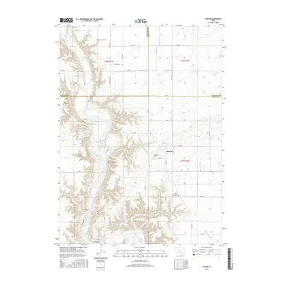
2015 Map of Fraser
USGS Topo · Published 2015About this map
The Des Moines River carves a deep, winding valley through this part of the central Iowa landscape, creating a sharp contrast between the eroded river bluffs and the level agricultural uplands. The settlement of Fraser sits on the river's eastern bank, while Ridgeport occupies higher ground to the northeast. This area shows a high density of small burial grounds, likely of significant interest to genealogists, including the Boone County Farm Cem and several family or community plots such as Shafer Gear Cem, Bethel Owen Cem, and Hardin Cem. The map illustrates the 21st-century rural grid system, where long-standing roads like Co HWY d64 and Nature Rd intersect various creeks, including Mineral Br and Elkhorn Cr, which drain into the primary river valley.
Find a feature on this map
63 named features on this map. Tap any name to fly to it.
Don’t see what you’re looking for? This feature index may not catch every label — zoom into the map to look around manually.
Map Details
Editions of this 2015 Fraser Map
This is the sole edition of this map. No revisions or reprints were ever made.
Other maps of this area

1916 · Boone
USGS Topo · 1:62,500

1923 · Lehigh
USGS Topo · 1:62,500

1951 · Ogden
USGS Topo · 1:62,500

1954 · Waterloo
USGS Topo · 1:250,000

1954 · Fort Dodge
USGS Topo · 1:250,000

1955 · Waterloo
USGS Topo · 1:250,000

1957 · Fort Dodge
USGS Topo · 1:250,000

1958 · Fort Dodge
USGS Topo · 1:250,000

1965 · Mackey
USGS Topo · 1:24,000

1965 · Fraser
USGS Topo · 1:24,000