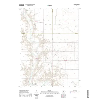
2018 Map of Fraser
USGS Topo · Published 2018About this map
The Des Moines River winds through a landscape of deeply cut ravines and high bluffs, defining the character of this Boone County region. This survey highlights the small riverside community of Fraser and the upland settlement of Ridgeport, connected by a grid of rural roads such as 130th St and Co Hwy D64. The area is notably dense with small family and community burial grounds that reflect the long-standing agricultural heritage of central Iowa. Genealogists will find a concentrated cluster of sites including Hardin Cem, Bethel Owen Cem, and Runyan Cem, along with the Boone County Farm Cem. The terrain is further shaped by tributaries like Mineral Br and Elkhorn Cr, which carve into the glacial till to meet the main river valley, creating a complex topography unusual for the surrounding plains.
Find a feature on this map
40 named features on this map. Tap any name to fly to it.
Don’t see what you’re looking for? This feature index may not catch every label — zoom into the map to look around manually.
Map Details
Editions of this 2018 Fraser Map
This is the sole edition of this map. No revisions or reprints were ever made.
Other maps of this area

1916 · Boone
USGS Topo · 1:62,500

1923 · Lehigh
USGS Topo · 1:62,500

1951 · Ogden
USGS Topo · 1:62,500

1954 · Waterloo
USGS Topo · 1:250,000

1954 · Fort Dodge
USGS Topo · 1:250,000

1955 · Waterloo
USGS Topo · 1:250,000

1957 · Fort Dodge
USGS Topo · 1:250,000

1958 · Fort Dodge
USGS Topo · 1:250,000

1965 · Mackey
USGS Topo · 1:24,000

1965 · Fraser
USGS Topo · 1:24,000