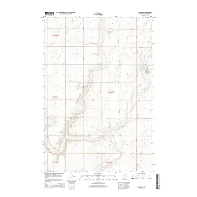
2015 Map of Frederick
USGS Topo · Published 2015About this map
Frederick stands as the primary hub of activity on this prairie landscape, situated where the Maple River flows toward its junction with the Elm River. The town's grid is clearly defined by local landmarks like Main St and 1st St, serving as the gateway to Frederick Lake. The surrounding terrain in Brown County is a network of section lines and watercourses, including the meandering Dry Br, which cuts through the agricultural blocks of T128N R64W and T127N R64W. This 2015 survey illustrates how the modern road system, defined by corridors such as 386th Ave, strictly follows the historic township and range divisions. The confluence of the Maple and Elm rivers dominates the southern half of the map, carving a winding path through the North Dakota borderlands.
Find a feature on this map
30 named features on this map. Tap any name to fly to it.
Don’t see what you’re looking for? This feature index may not catch every label — zoom into the map to look around manually.
Map Details
Editions of this 2015 Frederick Map
This is the sole edition of this map. No revisions or reprints were ever made.
Other maps of this area

1894 · Ellendale
USGS Topo · 1:62,500

1894 · Columbia
USGS Topo · 1:62,500

1894 · Savo
USGS Topo · 1:62,500

1896 · Columbia
USGS Topo · 1:125,000

1899 · Ellendale
USGS Topo · 1:125,000

1952 · Westport
USGS Topo · 1:24,000

1952 · Richmond NE
USGS Topo · 1:24,000

1953 · Savo SW
USGS Topo · 1:24,000

1953 · Frederick
USGS Topo · 1:24,000

1953 · Ellendale South
USGS Topo · 1:24,000