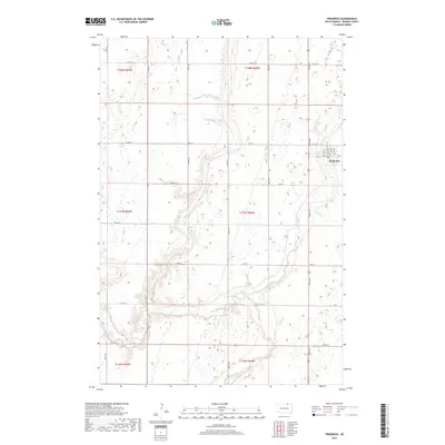
2017 Map of Frederick
USGS Topo · Published 2017About this map
The town of Frederick serves as the central hub of this Northern South Dakota landscape, situated near the confluence of several significant prairie waterways. The town layout is defined by a traditional grid including Main St and the transit-oriented Railway Ave, reflecting its roots as a regional transport point. Surrounding the settlement, the terrain is shaped by the winding courses of the Maple River and the Elm River, which converge in the southern portion of the area. The presence of Dry Br and numerous smaller wetland depressions suggests a dynamic prairie environment where water management and drainage are central to the local geography. This survey provides a clear look at the intersection of rural South Dakota township boundaries, such as t127n r64w and t128n r64w, as they were organized in the early 21st century.
Find a feature on this map
29 named features on this map. Tap any name to fly to it.
Don’t see what you’re looking for? This feature index may not catch every label — zoom into the map to look around manually.
Map Details
Editions of this 2017 Frederick Map
This is the sole edition of this map. No revisions or reprints were ever made.
Other maps of this area

1894 · Ellendale
USGS Topo · 1:62,500

1894 · Columbia
USGS Topo · 1:62,500

1894 · Savo
USGS Topo · 1:62,500

1896 · Columbia
USGS Topo · 1:125,000

1899 · Ellendale
USGS Topo · 1:125,000

1952 · Westport
USGS Topo · 1:24,000

1952 · Richmond NE
USGS Topo · 1:24,000

1953 · Savo SW
USGS Topo · 1:24,000

1953 · Frederick
USGS Topo · 1:24,000

1953 · Ellendale South
USGS Topo · 1:24,000