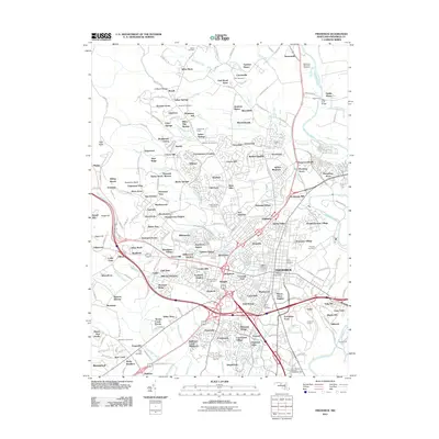
2011 Map of Frederick
USGS Topo · Published 2011About this map
The Monocacy River and its numerous tributaries, including Tuscarora Creek, Carroll Creek, and Ballenger Creek, define the topography of this Maryland landscape. In the early 21st century, the area surrounding the city of Frederick exhibits a complex pattern of suburban growth, with established residential enclaves like Yellow Springs and Hansonville bordered by modern developments such as Cloverview and Indian Springs. The presence of Fort Detrick in the central portion of the map indicates the significant military and research footprint in the region. Genealogists will find a high density of burial sites, ranging from the large Mount Olivet Cemetery to smaller locations like Zion Cemetery and Brook Hill Cemetery. Historical transport and river crossings are well-documented, evidenced by the named Biggs Ford and Crums Ford on the river, alongside the industrial site of the Frederick Quarry.
Find a feature on this map
234 named features on this map. Tap any name to fly to it.
Don’t see what you’re looking for? This feature index may not catch every label — zoom into the map to look around manually.
Map Details
Editions of this 2011 Frederick Map
This is the sole edition of this map. No revisions or reprints were ever made.
Other maps of this area

1884 · Harpers Ferry
USGS Topo · 1:125,000

1891 · Harpers Ferry
USGS Topo · 1:125,000

1893 · Frederick
USGS Topo · 1:125,000

1893 · Harpers Ferry
USGS Topo · 1:125,000

1894 · Frederick
USGS Topo · 1:125,000

1908 · Middletown
USGS Topo · 1:48,000

1908 · Ijamsville
USGS Topo · 1:62,500

1909 · Ijamsville
USGS Topo · 1:62,500

1909 · Hagerstown
USGS Topo · 1:48,000

1910 · Antietam
USGS Topo · 1:62,500