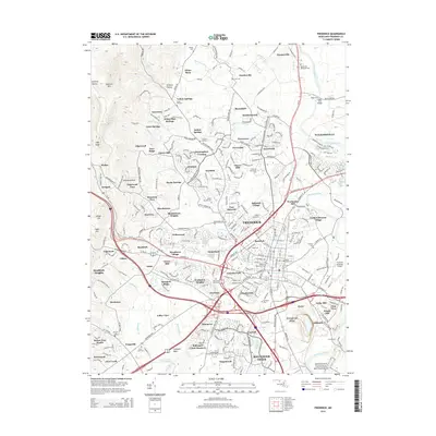
2014 Map of Frederick
USGS Topo · Published 2014About this map
Fort Detrick and the expanding urban core of Frederick dominate this mid-2010s landscape, where modern residential developments like Whittier and Clover Hill meet older rural crossroads. To the south, the Monocacy National Battlefield preserves the riverfront where Ballenger Creek joins the Monocacy River, a site of critical Civil War history. The map records several established academic and cultural landmarks, including Hood College, Frederick Community College, and the colonial-era Schifferstadt site. Transportation corridors such as Us-15 and Us-40 bisect the county, connecting the city to peripheral communities like Yellow Springs and Shookstown. Local genealogy is well-supported by the inclusion of numerous burial grounds, such as the prominent Mt Olivet Cemetery, Saint Johns Cemetery, and Resthaven Memorial Cemetery.
Find a feature on this map
143 named features on this map. Tap any name to fly to it.
Don’t see what you’re looking for? This feature index may not catch every label — zoom into the map to look around manually.
Map Details
Editions of this 2014 Frederick Map
This is the sole edition of this map. No revisions or reprints were ever made.
Other maps of this area

1884 · Harpers Ferry
USGS Topo · 1:125,000

1891 · Harpers Ferry
USGS Topo · 1:125,000

1893 · Frederick
USGS Topo · 1:125,000

1893 · Harpers Ferry
USGS Topo · 1:125,000

1894 · Frederick
USGS Topo · 1:125,000

1908 · Middletown
USGS Topo · 1:48,000

1908 · Ijamsville
USGS Topo · 1:62,500

1909 · Ijamsville
USGS Topo · 1:62,500

1909 · Hagerstown
USGS Topo · 1:48,000

1910 · Antietam
USGS Topo · 1:62,500