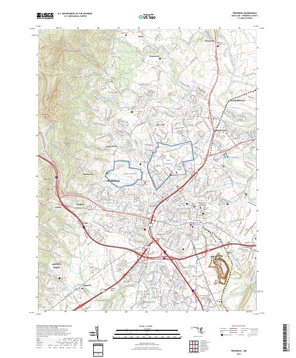
2023 Map of Frederick
USGS Topo · Published 2023About this map
Catoctin Mtn rises along the western edge of this Maryland landscape, framing the growth of Frederick and its surrounding communities. The map detail highlights a dense concentration of local history markers, particularly cemeteries such as Mount Olivet Cem and the Laboring Sons Memorial Ground Cem, alongside institutional landmarks like Hood College and the Frederick County Courthouse. The urban center is contrasted by the outlying agricultural and residential patterns of Walkersville, Ballenger Creek, and Braddock Heights.
Find a feature on this map
57 named features on this map. Tap any name to fly to it.
Don’t see what you’re looking for? This feature index may not catch every label — zoom into the map to look around manually.
Map Details
Editions of this 2023 Frederick Map
This is the sole edition of this map. No revisions or reprints were ever made.
Other maps of this area

1884 · Harpers Ferry
USGS Topo · 1:125,000

1891 · Harpers Ferry
USGS Topo · 1:125,000

1893 · Frederick
USGS Topo · 1:125,000

1893 · Harpers Ferry
USGS Topo · 1:125,000

1894 · Frederick
USGS Topo · 1:125,000

1908 · Middletown
USGS Topo · 1:48,000

1908 · Ijamsville
USGS Topo · 1:62,500

1909 · Ijamsville
USGS Topo · 1:62,500

1909 · Hagerstown
USGS Topo · 1:48,000

1910 · Antietam
USGS Topo · 1:62,500