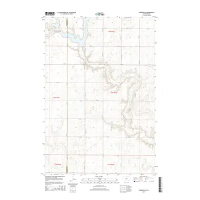
2015 Map of Frederick SW
USGS Topo · Published 2015About this map
Elm Lake and the meandering course of the Elm River dominate this portion of the northern plains, where the McPherson Co Brown Co line bisects a landscape defined by the Public Land Survey System. The map reveals the rigid grid of the Dakotas, where gravel and section roads like 373rd Ave and 105th St navigate around the natural drainages of Dry Run and the river’s wide, branching basin. This 2015 survey provides a clear look at the intersection of modern county infrastructure, including Cr-2, and the hydrologic features that have dictated the placement of homesteads and fields in this agricultural region for generations.
Find a feature on this map
25 named features on this map. Tap any name to fly to it.
Don’t see what you’re looking for? This feature index may not catch every label — zoom into the map to look around manually.
Map Details
Editions of this 2015 Frederick SW Map
This is the sole edition of this map. No revisions or reprints were ever made.
Other maps of this area

1894 · Ellendale
USGS Topo · 1:62,500

1899 · Ellendale
USGS Topo · 1:125,000

1952 · Richmond NE
USGS Topo · 1:24,000

1953 · Frederick
USGS Topo · 1:24,000

1953 · Ellendale South
USGS Topo · 1:24,000

1954 · Aberdeen
USGS Topo · 1:250,000

1956 · Aberdeen
USGS Topo · 1:250,000
1968 · Frederick NW
USGS Topo · 1:24,000

1968 · Forbes
USGS Topo · 1:24,000

1968 · Forbes SE
USGS Topo · 1:24,000