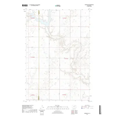
2017 Map of Frederick SW
USGS Topo · Published 2017About this map
Elm Lake occupies the northwestern corner of this territory, marking the transition from the glaciated plains of McPherson and Brown counties. The landscape is defined by the winding course of the Elm River, which meanders southeastward across the prairie, its path traced by sharp topographic relief against the surrounding flatlands. This drainage network is further supported by the intermittent flow of Dry Run, which cuts through the southern reaches of the quadrangle.
Find a feature on this map
26 named features on this map. Tap any name to fly to it.
Don’t see what you’re looking for? This feature index may not catch every label — zoom into the map to look around manually.
Map Details
Editions of this 2017 Frederick SW Map
This is the sole edition of this map. No revisions or reprints were ever made.
Other maps of this area

1894 · Ellendale
USGS Topo · 1:62,500

1899 · Ellendale
USGS Topo · 1:125,000

1952 · Richmond NE
USGS Topo · 1:24,000

1953 · Frederick
USGS Topo · 1:24,000

1953 · Ellendale South
USGS Topo · 1:24,000

1954 · Aberdeen
USGS Topo · 1:250,000

1956 · Aberdeen
USGS Topo · 1:250,000
1968 · Frederick NW
USGS Topo · 1:24,000

1968 · Forbes
USGS Topo · 1:24,000

1968 · Forbes SE
USGS Topo · 1:24,000